

Drive through Crandall or Seagoville and the signs of metropolitan expansion are hard to miss. New subdivisions, commercial projects and construction equipment mark land being prepared for development.
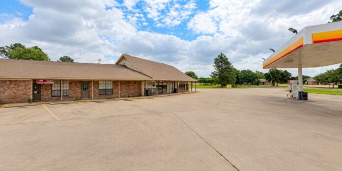
Drive into Combine, and the landscape changes. Large residential lots remain common, and agricultural land still separates neighborhoods.
Commercial development is comparatively limited. There are few signs of the tightly packed subdivisions that have transformed other communities along and east of U.S. Highway 175.
That difference is not simply a matter of developers overlooking Combine. A review of the city’s zoning regulations, subdivision requirements and recent City Council actions shows that Combine has maintained a fundamentally different development model. That model is built around large lots, limited density and significant requirements for anyone seeking to subdivide land.
The result is a city that continues to grow, but on terms substantially different from communities that are developing more quickly.
One Acre Is the Starting Point
Perhaps the clearest explanation can be found in Combine’s residential zoning rules.
The city’s R-1 Single Family Residential District requires each house to sit on at least one net acre of usable land after easements. The minimum lot width is 150 feet, and residential construction must meet substantial setback requirements.
That single provision dramatically changes what can be built. A developer working with 100 acres in another city might create hundreds of residential lots. The exact number would depend on zoning, streets and drainage requirements.
Under Combine’s basic residential zoning model, that same acreage cannot be converted into a densely built suburban subdivision. Land is also consumed by roads and drainage. Easements and other infrastructure requirements further reduce the number of homes that can be placed on a property.
Combine’s manufactured housing district also generally requires one net acre per home, while mobile home rental parks are prohibited.
The one acre philosophy extends beyond housing. The city’s General Business zoning regulations also require a minimum one net acre lot. Industrial property carries a one acre minimum as well. Those requirements do not prohibit development. They simply determine its scale.
Agriculture Remains Part of the Plan
Combine’s zoning code also provides another clue about how the city views undeveloped land.
Its Agricultural District is specifically designed for areas presently used for agriculture where urban services are not yet available. The regulations state that such land should remain appropriate for agricultural use until needed for urban purposes consistent with the city’s comprehensive planning.
That is substantially different from treating vacant acreage simply as land waiting for the next subdivision. Agriculture, ranching and large residential tracts remain legitimate long term land uses within Combine’s regulatory structure.
That helps explain why the city can sit within the rapidly expanding region around Dallas and Fort Worth while retaining stretches of open land that might have been developed much more intensively elsewhere.
Developers Carry Infrastructure Costs
Subdivision regulations add another layer. Developers are responsible for meeting city requirements for new subdivisions. Those requirements cover streets, water systems and drainage facilities.
New subdivisions must provide water systems meeting city standards. Larger developments can trigger sidewalk requirements. Streets, drainage and engineering plans are also reviewed through the city’s development process.
Combine’s regulations also restrict construction activity before required plats and engineering plans have been approved. These requirements serve an important municipal purpose: preventing new development from creating infrastructure problems that existing taxpayers later have to solve.
But they can also affect development economics. A project built around large lots while requiring extensive infrastructure spreads those construction costs across fewer homes than a subdivision built at higher density would. That can make Combine less attractive to developers whose business models depend on placing large numbers of homes on relatively small parcels.
Council Continues Revisiting Development Rules
Recent City Council records show that Combine’s approach is not merely the residue of ordinances that are decades old. City officials have continued revisiting the rules governing development.
The City Council approved significant amendments to its zoning and land development regulations in April 2026 after public hearings and Planning and Zoning Commission review. The revisions addressed residential and manufactured home districts.
The amendments also covered agricultural, commercial and industrial districts. Subdivision regulations were updated as well. The updated rules retained Combine’s one acre residential standard.
Council members also amended fees related to development. The changes covered replats, amended plats and minor plats. Requirements for property owner notifications were updated as well.
Separately, officials have spent months discussing what city records describe as a baseline development agreement — a potential framework intended to ensure that future developments comply with city standards while allowing additional requirements to be negotiated when necessary. The proposal has been tabled while officials work on its language. Even the discussions illustrate how closely development is being examined before projects move forward.
In early 2026, officials also considered a first responder fee. The fee would have applied to new developments, subdivisions and permit applications. Officials ultimately rejected the idea.
Taken together, the actions do not indicate a prohibition on development. Instead, they show a city continually refining how development will occur.
Crandall Chose Another Path
The contrast with nearby Crandall is particularly striking. Crandall’s recently adopted comprehensive planning documents describe a community preparing for significant continued population growth.
The city reported issuing 213 single family residential permits in 2023 alone — more than 19 percent of all such permits issued in Kaufman County that year. Crandall’s planning work also examines a scenario in which the community captures thousands of additional households expected to enter the region through 2050.
Its current Unified Development Code project is specifically intended to modernize zoning, subdivision and development standards while making the development process easier to navigate.
In other words, Crandall is not merely reacting to growth. It is planning for substantially more of it.
Seagoville Continues Expanding
Seagoville is following its own growth trajectory. City financial documents describe continued residential subdivision development along with retail and industrial investment, particularly around the Highway 175 corridor.
Seagoville officials describe that expansion as managed growth. They also project the city eventually reaching full development. That produces a markedly different development landscape from Combine, despite the communities being only minutes apart.
Combine Is Growing, Just Differently
Combine should not be mistaken for a city frozen in time. The population was 2,245 in the 2020 Census. Texas demographic estimates placed it at approximately 2,400 residents only a few years later.
Homes continue to be built. Property is replatted. Zoning questions reach the Planning and Zoning Commission and City Council. Growth is occurring.
What Combine has largely avoided is the development intensity appearing elsewhere in the region. There is no single council vote that explains that difference. Instead, it is the cumulative effect of years of land use decisions.
Those decisions include one acre residential lots, large setbacks and agricultural zoning. They also include development standards, subdivision controls and infrastructure requirements.
Each regulation may appear technical when considered separately. Together, they shape the physical character of an entire city.
Crandall prepares for thousands of additional households. Seagoville expands residential and commercial development along one of the region’s major highway corridors. Combine continues operating under a model that leaves considerably more land between houses, businesses and neighborhoods.
That may be exactly the point for residents concerned about traffic, density and the disappearance of open land. For developers seeking the economics of conventional suburban growth, it represents a very different equation.
And as development pressure continues spreading southeast from Dallas and across Kaufman County, Combine’s zoning map and subdivision ordinance may prove to be among the most consequential documents determining whether the city continues looking different from its neighbors.